The last post [
a bigger picture] raised some interesting questions - I've replied to a couple through
comments, but also realise I can chat a bit more about
types of drawing media [even show a couple of examples immediately to hand - though not all would be fantasy related, or a little more experimental] at a later date, and if their is interest.
In the interim, I'd like to post a couple of examples of maps. Not necessarily the best, but they were fun to do, as one of the elements of illustrating for me is trying to envisage a, for lack of a better term at the moment, 'bigger picture'. So here are some examples; first from the
Fabled Lands series designed by Dave Morris and Jamie Thomson.
At this point, I had another map to post that showed an actual small town in England , but now realise that the only scan I can raise [at present] is actually tiny - thus
the best laid plans of mice and beasties.
Still, as we are 'looking' at
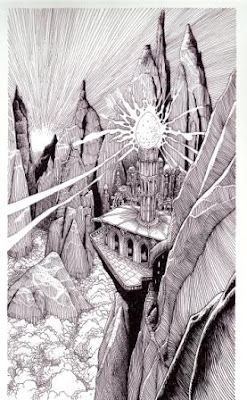
Fabled Lands, let's look at some images from that series, where I tried [as was the intent] of visually showing the Land in all it's variety and diversity.
I did a similar task with a world that was to be called '
Abraxis' , with it I created a map, cities, peoples, creatures, and so on; it never saw the light of print, and only my 'sketch studies' were ever 'finished', but again if anyone asks, they'll be a post.


